This article contains advertising. Our booking links are routed through a partner that adds commission tracking automatically, so if you book through one we earn a commission from the provider, at no extra cost to you. It never affects what we recommend. Affiliate disclosure
Penny Lane is a real Liverpool street, a real bus terminus, a real barbershop, and a real fire station. It’s also one of the most famous addresses in pop music — the subject of Paul McCartney’s 1967 song that, paired with John Lennon’s “Strawberry Fields Forever,” produced what many consider the greatest double A-side single ever released. The catch is that the Penny Lane you find on a map of Liverpool today is a quiet suburban street running south through Mossley Hill, and the famous shelter in the middle of a roundabout sits not on Penny Lane itself but at the junction of Smithdown Road and Allerton Road, half a mile north in what is technically Wavertree. Visiting takes some unpicking. This Penny Lane Liverpool guide walks you through what to see, where it actually is, how to get there from the city centre, and how to combine the visit with the other suburban Beatles sites — Strawberry Field, Mendips, 20 Forthlin Road, St Peter’s Woolton — that sit a short drive from the famous junction.
Penny Lane is one of the headline stops on the Magical Mystery Tour coach tour and an essential entry on the self-guided Beatles walking tour, but for visitors who’d rather not take the coach, this guide covers the suburban itinerary you can build yourself. The parent Beatles Liverpool guide places it all in the broader Beatles tourism context.
Where is Penny Lane?
Penny Lane is a half-mile residential street in south Liverpool, running south from the Smithdown Place junction (where Smithdown Road meets Allerton Road) down to Greenbank Road. It sits in Mossley Hill in south Liverpool, an easy trip from the city centre by car, taxi or bus, though traffic on the way out can slow you down.
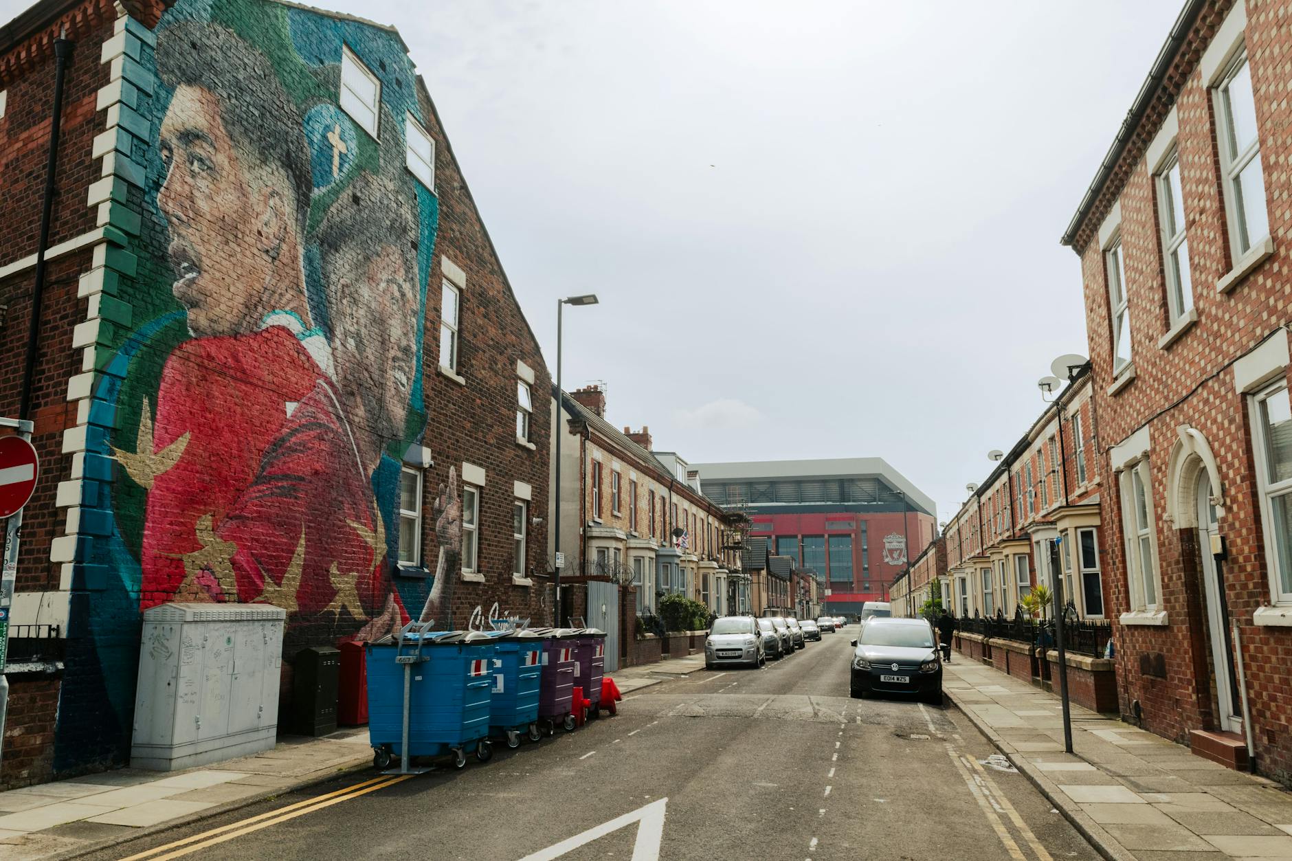
What most people think of as “Penny Lane” — the area in the song — is actually a slightly larger zone centred on the Smithdown Place roundabout, where Penny Lane meets Smithdown Road, Allerton Road, Church Road, and Greenbank Road. This roundabout is the location of the famous bus shelter referenced in the song’s lyrics. The street called Penny Lane runs south from this roundabout. The shelter and the barbershop are at the junction itself, with the bank and other landmarks from the lyrics in the streets around it; the fire station is further off, on Mather Avenue.
This geographic vagueness is part of the song. McCartney wrote “Penny Lane” from a child’s mental map of the area — the sounds, smells, and characters of the wider neighbourhood, anchored by the bus terminus where he and John Lennon met regularly as teenagers. You’ll get the most out of visiting if you treat Penny Lane as a neighbourhood, not just a street.
The History Behind Penny Lane
The lane itself is far older than the Beatles: a laneway on its line appears on Liverpool maps in the 18th century. The name comes (depending on which source you trust) from either a turnpike toll of one penny, a local landowner, or — more controversially — the 18th-century Liverpool slave-ship owner James Penny. As Liverpool grappled with its slavery legacy, the city council debated the name in 2006, and signs were defaced in 2020, though museum research found no evidence that the street was named after him.
In the late 19th and early 20th century, the area became a major tram and bus terminus. The intersection at Smithdown Place was where multiple Liverpool tram and bus routes turned around, with the famous purpose-built shelter providing a covered waiting area and toilets. For most of the 20th century, “Penny Lane” on a destination board was a familiar sight on Liverpool buses. The Beatles’ route to and from the city centre as schoolboys and teenagers ran through here repeatedly — Paul McCartney lived nearby in Allerton, John Lennon further out in Woolton, George Harrison in Speke. The Smithdown Place shelter is genuinely the place they met to plan things, hang out between buses, and start the friendships that would become the band.
The Beatles and Penny Lane: What the Song Is Actually About
Released on 17 February 1967 as a double A-side with “Strawberry Fields Forever,” “Penny Lane” was Paul McCartney’s song, begun in December 1966 as a track for the album that became Sgt. Pepper’s Lonely Hearts Club Band. (Both songs were eventually left off the album to make room for new material, which George Martin later described as the worst decision of his career.)
The lyrics are a deliberately surreal, childhood-tinted reminiscence — McCartney working from his memories of the neighbourhood, filtered through the late-1966 psychedelic mood, with biographer Ian MacDonald singling out one of its lyrics as among the more “LSD-redolent phrases” in the Beatles catalogue. The famous characters and landmarks are all real, or were:
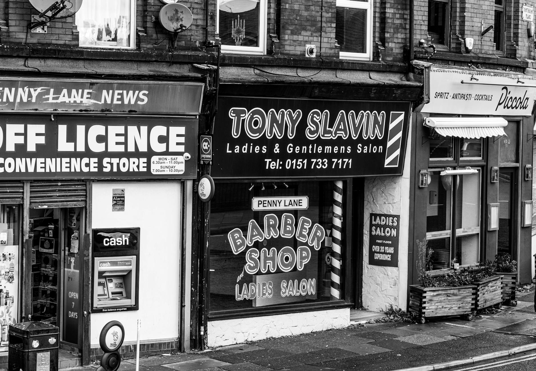
- “A barber showing photographs / Of every head he’s had the pleasure to have known” — Bioletti’s barbershop, on Smithdown Place at the entrance to Penny Lane. The shop is still there as Tony Slavin Barbers, with new ownership but the same trade and now a famous tourist photograph spot.
- “On the corner is a banker” — there was indeed a bank on the corner (Lloyds, now closed; the building remains).
- “The fireman with an hourglass” — Mather Avenue Fire Station, close to Penny Lane, is still operational.
- “Behind the shelter in the middle of a roundabout” — the purpose-built tram shelter at Smithdown Place is still there; it was later turned into Sgt. Pepper’s Bistro, which closed in 2003.
- “A pretty nurse is selling poppies from a tray” — a Remembrance Day reference, common in the early 1960s when McCartney was forming the memories.
The song’s genius is in turning a specific suburban Liverpool junction — utterly mundane, the kind of place teenagers wait for the bus — into a universal evocation of childhood, place, and a certain melancholy English nostalgia. The result is one of the most carefully observed songs about a real place ever written.
What You’ll See When You Visit Penny Lane Today
The Penny Lane Street Sign
The original street signs were so frequently stolen by Beatles fans through the 1970s and 80s that Liverpool City Council resorted to painting “Penny Lane” directly onto the brick walls of corner buildings. The current physical street signs are mounted high enough to be steal-resistant, and you’ll find tourists taking photographs with them at multiple points along the street.
The Shelter in the Middle of the Roundabout
The Smithdown Place shelter — a small octagonal building at the centre of the roundabout — is technically the “shelter in the middle of a roundabout” from the lyric, though it’s actually a tram and bus terminal shelter rather than a roundabout-island structure. It has been variously a waiting room, a café and a Beatles-themed coffee shop, and it was Sgt. Pepper’s Bistro until 2003. Treat it as something to photograph from the roundabout rather than a stop to plan around.
Tony Slavin Barbers (formerly Bioletti’s)
The barbershop referenced in the song. Different ownership now, but still cutting hair on the same site at Smithdown Place. The shopfront is one of the most photographed in suburban Liverpool. The current owners are accustomed to Beatles tourists and will tolerate you taking a photograph of the exterior; ask politely if you want a photograph inside.
Dovedale Towers
On Penny Lane south of the Smithdown Place junction, Dovedale Towers is a striking Gothic-revival building, now operating as a pub and venue. The building’s tower features in several Beatles-era photographs of the area.
St Barnabas Church
On Penny Lane itself, this is the church where Paul McCartney sang as a choir boy in his early teens. The church is open during services and for occasional events; the exterior is worth a photograph for the McCartney connection.
The Penny Lane Wine Bar
A long-running independent wine bar and restaurant on Penny Lane itself, a favourite local hang for decades. Worth a stop for a coffee or a glass of wine while you’re absorbing the area — feels far more authentic than the explicitly Beatles-themed venues.
How to Get to Penny Lane
By Bus
The cheapest option. From Liverpool ONE bus station, take the 86 bus south along Smithdown Road and get off at Allerton Road/Penny Lane. Allow at least half an hour, and longer at busy times. Departures vary through the day and the route is shared between operators, so check the timetable for the day you travel.
Alternatively, the 80A and 80B also serve the Penny Lane area. Adult single fares are £2 under the City Region’s fare cap. If you’re combining Penny Lane with Strawberry Field or other south Liverpool sites the same day, check Merseytravel’s site for current day-ticket prices.
By Train
By rail, Mossley Hill to the south and Edge Hill to the north are both served by Northern trains from Liverpool Lime Street, with a walk at the other end. The bus is more convenient for the direct Penny Lane visit; the train works better if you’re combining with a longer south Liverpool itinerary.
By Taxi or Uber
A direct taxi from Liverpool city centre to Penny Lane costs around £10-14, journey time 15 minutes. The right choice if you’re short on time or planning to make a Penny Lane / Strawberry Field / Mendips loop.
By Coach Tour
The Magical Mystery Tour coach (from £21.95 per adult, two hours) and several private operators include Penny Lane on a wider Beatles suburban loop that also covers Strawberry Field, Mendips, and Forthlin Road. The right choice if you don’t want to manage the logistics yourself. Hop-on-hop-off Beatles bus tours also serve the area.
By Car
Limited but available street parking around Penny Lane, free in most stretches. The roundabout is busy at rush hour; weekends and mid-mornings are easier for driving and parking.
Combining Penny Lane With the Other South Liverpool Beatles Sites
This is where Penny Lane visits get really good. A short drive from the Smithdown Place junction are four more essential Beatles sites — and a self-driven or taxi-routed half-day combining them is one of the great Beatles experiences. Here’s the loop:
Penny Lane (Smithdown Place) — start here. 45 minutes for the shelter, barbershop and street signs.
20 Forthlin Road (Allerton, a short drive south) — Paul McCartney’s family home from 1955 to 1964. Where many early Lennon-McCartney songs were written. National Trust property, by guided tour only. Book ahead. See the Lennon and McCartney childhood homes guide for full details.
Mendips, 251 Menlove Avenue (Woolton, a short drive further on) — John Lennon’s family home, where he lived with his Aunt Mimi from the mid-1940s until 1963. Also National Trust, also tour-only. Combined ticket with Forthlin Road.
Strawberry Field (Woolton, close to Mendips) — the Salvation Army children’s home that inspired Lennon’s song. Now a visitor exhibition with the famous red gates outside. See the Strawberry Field guide.
St Peter’s Church, Woolton (in Woolton village) — where John Lennon and Paul McCartney met for the first time on 6 July 1957, at the Woolton Village fête. The churchyard also contains the gravestone of Eleanor Rigby — a real person whose name McCartney may or may not have unconsciously borrowed.
The whole loop is comfortably done in 4-5 hours including the National Trust tour at Forthlin and Mendips. The Magical Mystery Tour coach (which doesn’t enter the childhood homes — only the National Trust does that) covers Penny Lane, Strawberry Field, and St Peter’s in two hours.
Non-Beatles Things to Do Near Penny Lane
If you’re building a full half-day around Penny Lane, the wider south Liverpool area has plenty of complementary stops:
Sefton Park and the Palm House — within walking distance, to the west of Penny Lane. The 235-acre Victorian park is one of the great UK city parks, with the Sefton Park Palm House at its heart. Free, atmospheric, perfect for a brunch break. See the parks and gardens guide.
Lark Lane — the bohemian café strip on the eastern edge of Sefton Park. Excellent for brunch, lunch, or a long afternoon coffee. The Tavern Co., Belzan, and Dovedale Towers are all worth knowing about.
Calderstones Park — a short drive south-east. Neolithic standing stones, the thousand-year-old Allerton Oak, Japanese gardens. See the parks guide.
Greenbank Park — close to Penny Lane. A small, quiet park with an ornamental lake and Chinese-style bridge. Often empty.
Photography Tips for Penny Lane
The street sign photographs. The most photographed Penny Lane signs are at the Smithdown Place junction and at the south end where Penny Lane meets Greenbank Road.
The shelter and barbershop. Stand at the Smithdown Place junction looking south down Penny Lane to get both the shelter and the Tony Slavin barbershop in the same wide shot. Best light is mid-morning to early afternoon.
Crowds. Weekday mornings are quiet. Magical Mystery Tour coaches and other Beatles tours stop here through the day, so if a coachload of tourists is photographing the same spots, wait a little and they’ll move on.
The fire station. Mather Avenue Fire Station is a short drive south. Less photographed than the rest, but a real Beatles-pilgrimage box-tick if you’re working through the song’s landmarks.
Penny Lane Liverpool FAQs
Is Penny Lane the actual street the Beatles sang about? Yes — it’s the real street in south Liverpool. The shelter, the barber and the bank are around the Smithdown Place junction, while the fire station the song recalls is on Mather Avenue.
Can I see the famous barbershop? Yes — Tony Slavin Barbers, on the Smithdown Place junction at the entrance to Penny Lane. Different ownership now, but on the same site as the Bioletti’s referenced in the lyrics. Photograph the exterior; ask politely for interior shots.
What is the shelter in the middle of the roundabout? An octagonal tram and bus terminal shelter at the Smithdown Place junction, dating from the early 20th century. It was Sgt. Pepper’s Bistro until 2003.
How long should I spend at Penny Lane? 45 minutes to an hour if you’re just doing Penny Lane itself. 3-4 hours if you’re combining with Strawberry Field, Mendips, and Forthlin Road for the full south Liverpool Beatles loop.
Can I take a guided tour of Penny Lane? Yes — the Magical Mystery Tour coach is the headline option (covers Penny Lane, Strawberry Field, and the childhood homes’ exteriors). Several private operators run smaller-group Beatles taxi tours. Self-driving or self-bussing is also entirely feasible.
Is Penny Lane in Wavertree or Mossley Hill? The street itself is on the boundary, with addresses on Penny Lane falling into both districts depending on the section. The Smithdown Place junction (the “shelter in the middle of a roundabout”) is technically in Wavertree. Most maps simply label the area as “Penny Lane.”
What does Penny Lane mean? The lane is far older than the Beatles and shows up on 18th-century maps. Disputed origins include a turnpike toll of one penny, a local landowner, or 18th-century Liverpool slave-trader James Penny — the latter contested but historically documented in the slavery archive.
Is Penny Lane safe to walk around as a tourist? Yes — the area is a busy suburban junction with shops, cafés, bars, and a steady stream of buses and pedestrians during the day. Standard urban precautions apply at night. The area has a normal residential character, not a tourist-trap atmosphere.
Why Penny Lane Is Still Worth Visiting
You might think a half-hour at a suburban bus terminus three miles south of central Liverpool would be a let-down after the build-up of the song. It isn’t, for two reasons. First, the location is exactly as McCartney described it. The shelter is still there. The barbershop is still cutting hair on the same corner. The fire station is still in service. The bank is still on the corner. The streetscape is utterly continuous with what the song describes, and the act of standing at the junction with the song’s opening flute trill in your head produces a small, specific frisson that most music tourism never achieves.
Second, the visit is the gateway to the broader south Liverpool Beatles itinerary — Strawberry Field, the childhood homes at Mendips and Forthlin Road, St Peter’s Woolton, the meeting of John and Paul at the Woolton fête in July 1957. These suburban sites form a self-contained Beatles half-day that complements the Cavern Quarter perfectly. The Cavern Club gives you 1961-63 Beatles; Penny Lane and Woolton give you the pre-Beatles, the 1956-57 schoolboys who would write the music.
Allow at least an hour at Penny Lane itself, and plan to combine it with at least Strawberry Field and St Peter’s Woolton on the same trip. The National Trust homes need advance booking and run as a guided tour of their own, so leave room for that and for the travel between sites.
For full coverage of how Penny Lane fits into the wider Beatles tourism in Liverpool, the Beatles Liverpool guide is the parent. The Strawberry Field guide, childhood homes guide, Cavern Club guide, and Beatles in Liverpool timeline cover the surrounding pieces. And for the practical route, the self-guided Beatles walking tour shows how the city-centre and suburban sites slot together over a day.